What a great project! Imagine having 120 million polygons on screen at once!
14 Likes
Wow, that’s great! How long did it take you to vector and then actually cut and assemble?
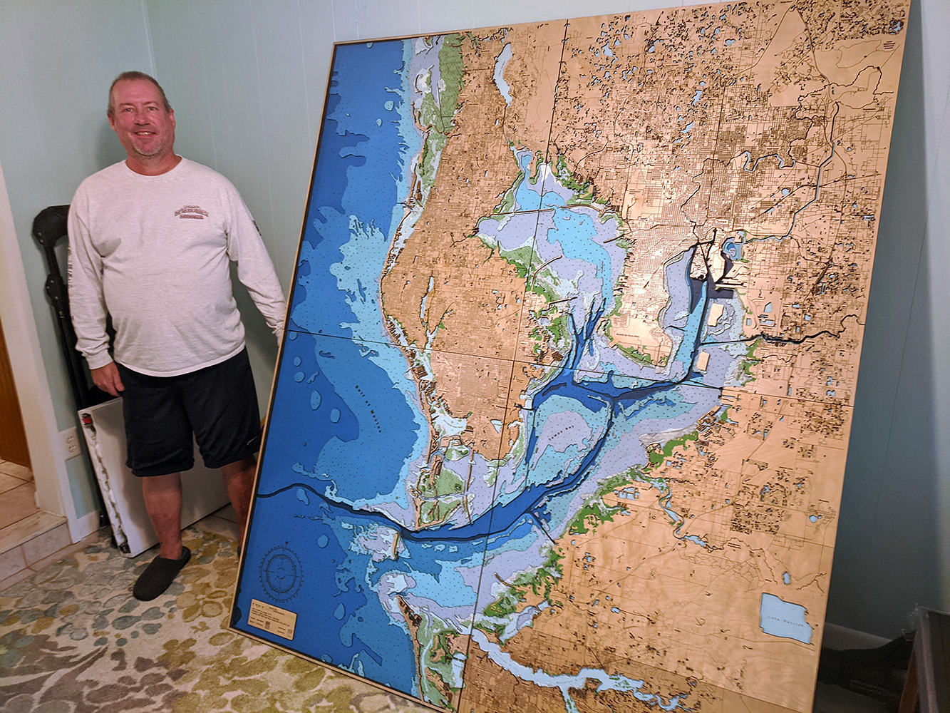
Thanks Tim - Everything is vector from the start. I’m a GIS Scientist so everything is based on data and the geo-database I built. Total project time was about 4 months.
2 Likes
Dean, I was wondering if you could make a tutorial how to make one of these maps using QGIS. Where to gather the data and how to use the topography and bathymetry data to make something like this on a smaller scale and incorporate in the roads as well.
1 Like
Hi Wayne, this is one area you have to have the background in GIS science. All the data is manipulated through formulas I’ve written. The software is customized by scripts and I worked with a software developer as we changed the current release of their GIS software. My Bachelors is in Cartography and my Masters is in 3D analytical GEO-science. So what has taken me 20 years to develop can not be summed up in a tutorial nor would I feel obliged to give that away. It’s like asking the Colonel for the KFC recipe, you know? lol. This is not my hobby, it’s my full time gig so I’m happy to talk about lasing, concepts, large bed lasers, air control and humidity issues, etc.
2 Likes
Nicely done.
How does LightBurn fit into this workflow? No KFC issue with sharing how you use LightBurn and where in the process you find benefit over other tools you use.
@Wayne519, not Dean’s details/tutorial but this is a place to start: https://medialoot.com/blog/how-to-turn-a-map-into-an-artistic-line-drawing/
Hi Rick - Lightburn is an incredible tool and keeps getting better. 100% of my processing this much data, had to be done in a SQL database environment. Once things met my criteria things were further processed and separated in Illustrator. Nothing was ever rasterized in any way. No maps are copied either. When I work on a study like sea grass and oyster bed management with NOAA or USGS I use the same procedures.
When my project is ready and polygon and nodes are reduced it gets exported into Lighburn where it is cut. All processing is already done so it’s just a matter of power, speed and air. Lightburn is the conduit to the laser for me but not the development tool.
BTW, I built a monster of a machine to do this project. Ryzen 9 3900x 12 Core Processor, 128 gigs of ram, 3 NVMe drives raid 0 striped (windows 10 loads in 3 seconds), dual RTX 2070 Super video cards and dual 5k displays. The project would take about 2 minutes to open and 3 minutes to save until I could separate things.
1 Like
Thank you for sharing. This is some impressive work and a nice system you have assembled to do the crunching. For fun, what is the number of ‘Objects’ LightBurn reports for your largest file you run? To check, ungroup, and select everything in that file, then look to the ‘Status’ displayed at the bottom.

That’s pretty amazing. Awesome work!
That would take some time to figure out. We are talking 28 layers plus each layer could have up to 16 different types of elements. I’ll look when I can. I do remember having to carefully work with loading the files on the Ruida 422x. Thanks for the nice compliments.
@animapper thanks for the reply, keep up the incredible work!
You look so proud standing next to your “baby”
Very inspirational! I’m working on one for the Columbia River area incorporating Portland , Oregon(yeahhh…that Portland  ) and Vancouver Washington Area.
@animapper what machine did you use and what size bed ?
Looks like it was a 4 piece tiled project. The pieces look to me to be approx 48” x 60”
Do tell!
Great  show
show

Thanks. Yes it’s a tiled project. Bed is 55" x 36" Boss LS3655 - 180 watt, panels were about 35" x 45". Tiling is very challenging when working with vector files to insure they don’t change shape at the node cuts.
We just made this easier to accomplish with the addition of our ‘Cut Shapes’ tool.
From the announcement:
Cut Shapes tool
LightBurn has a new tool for cutting shapes. It’s similar to the Boolean tools, but smarter - Shapes keep their original layer settings, and it understands that filled shapes need to be closed, but line cuts need to be left open. The Cut Shapes tool does not work on images (yet) but we plan to support this in the future as well.
We’ll be producing a couple of different videos showing how to use the new Cut Shapes tool, but for now, select some shapes, then select a closed outline to use as the cutting shape, and go to Tools > Cut Shapes. The result will be two groups - One for everything inside the cutter, and one for everything else.
1 Like
Thanks Rick - this should prove interesting. I need to cut through all layers at once so we’ll see if I can even load the file. It’s nearly a half Terabyte.
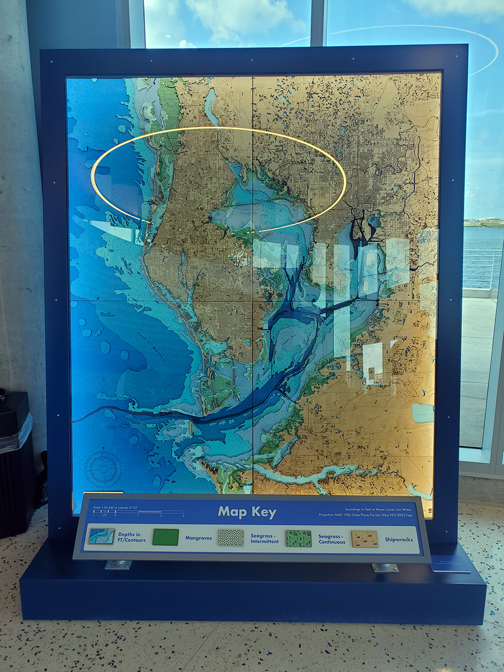
I was commissioned because of the science. The studies we present on the map have been included. That’s nearly 30 years of sea grass plantings, eco-restoration of mangroves, oyster bed building, dredge tilling locations among other things. So, when I post something on Lightburn the assumption is it’s an art piece. Indeed it is but the science comes first. It was expensive - just under 6 digits. The display we had to build to hold the map required cooling fans, LED diffused lighting, 8" hidden wheels, museum anit-refractive glass ($3500 alone).
I’ve been doing museum displays like this since 2008. If you want any help on your NW project let me know.
This stuff is crazy expensive. Looked into protecting some art in our home that gets a lot of sunlight. Sticker shock when we first started getting quotes for this glass.
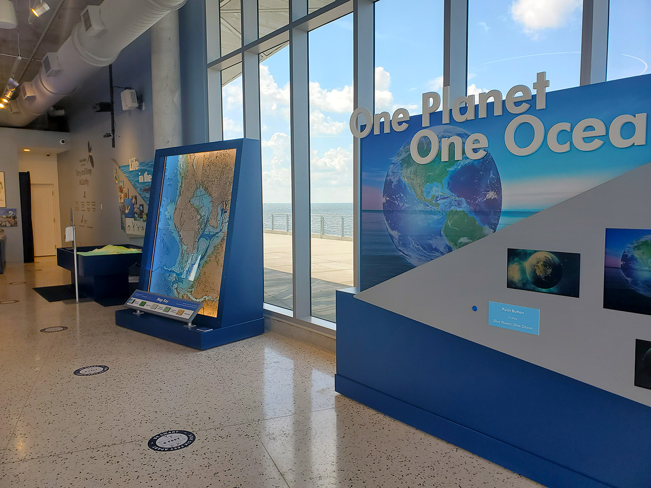
We all know there are 4 or even 5 (named) oceans. What is the reason or agenda behind calling it One Planet/ One Ocean? I get that the oceans all constitute one body of water, but I don’t get this new re-labeling. Can you please expand on that? Thanks.
Hi Steven,
Things like this are not from the scientific community as much as the marketing areas for social awareness. We are continuing to label things correctly but the message is basically to be more aware of our impact and points of mitigation we all can get behind.
3 Likes