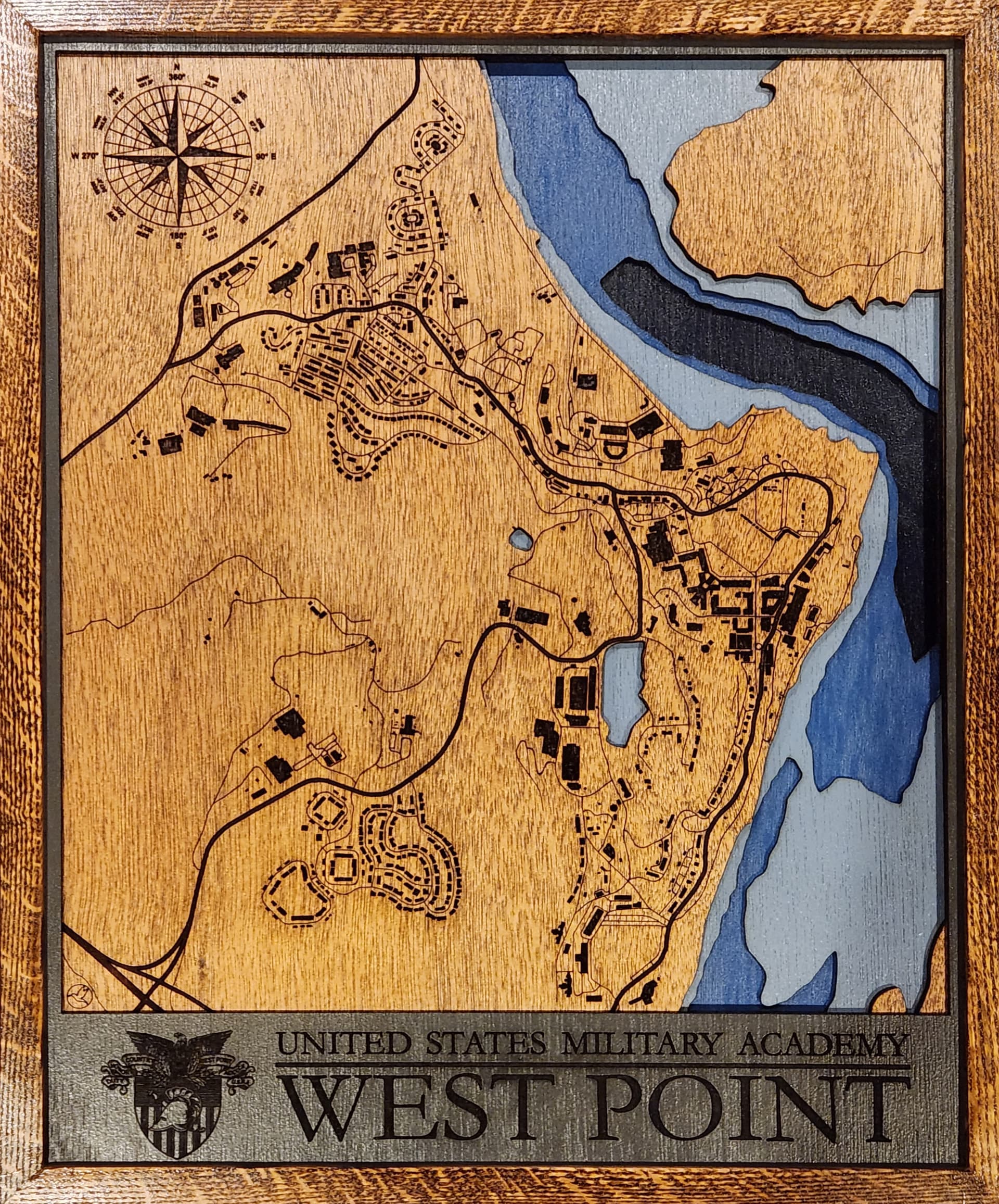
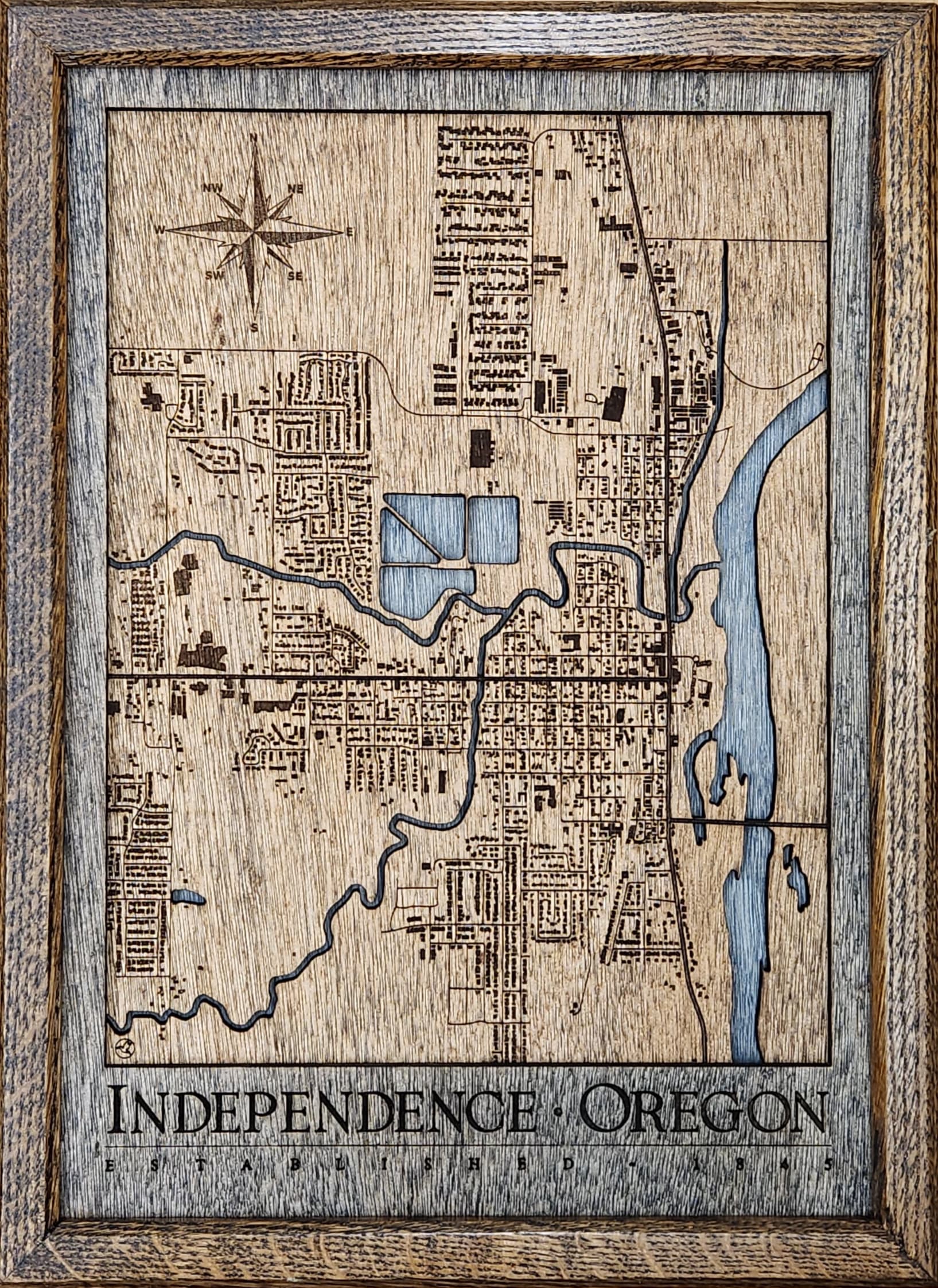
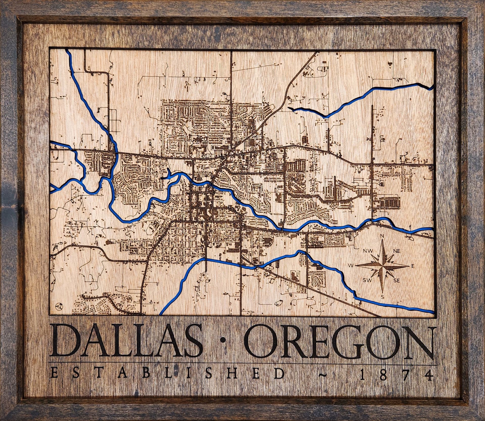
Custom built with QGIS and public domain data .
8 Likes
Are those frames or engraved to look like them?
I’ve tried doing this and didn’t get very far. The maps for a small town are not very detailed to separate them.
Any suggestions?
![]()
Frames were built out of Red Oak.
I used QGIS to build my maps. With the right filters, you can get to Primary, Secondary & Tertiary roads, which usually yields alot of small roads. Exporting out as vectors allows me to get single stroke roads that burn fast rather than engraved/fill passes for them.
Thanks for the details! I was wanting to do a Long Island, NY for my son in NY.
I did one for Tampa Bay, but it was from a nautical map and 4 layers, no roads. I figured out why these are so expensive.
Yeah, it takes me about 3 - 4 hrs to build the map so I can extract the layers I need. If it has bathymetry data (water depths) then it takes a bit longer as that data is pretty sketchy to get ahold of sometimes, depending upon where it is.

It took me 3 or 4 map iterations to figure out all the steps & get the files in a format that allowed a “reasonable” burn time for cutting & engraving.
4 Likes
I really appreciate you sharing the How-To on this. Thanks ![]()